
000 290th Street, Saint James, MN 56081
$3,218,694

Property Type:
Land
Lot Size (sq. ft.):
8,423,633
Status:
Closed
Current Price:
$3,218,694
List Date:
11/28/2022
Last Modified:
6/03/2025
Overview
Description
Listing Details MLS# 6312727
General Property Information
- Comp Sale YN
- No
- Is Buyers Premium
- No
- Lot Measurement
- Acres
- Multiple PIDs?
- Yes
- Plat Recorded
- No
- Yearly/Seasonal
- Yearly
- Zoning
- Agriculture
- Acres
- 193.38
- Lot Size SqFt
- 8423632.8
- Assessment Pending
- Unknown
- Association Fee
- 0
Property Features
Available Utilities:
None Connected
Development Status:
Raw Land
Improvements:
Public Road
Land Inclusions:
None
Special Listing Conditions:
Auction
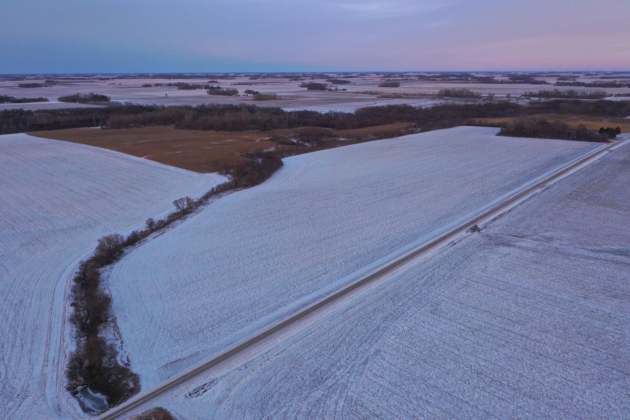
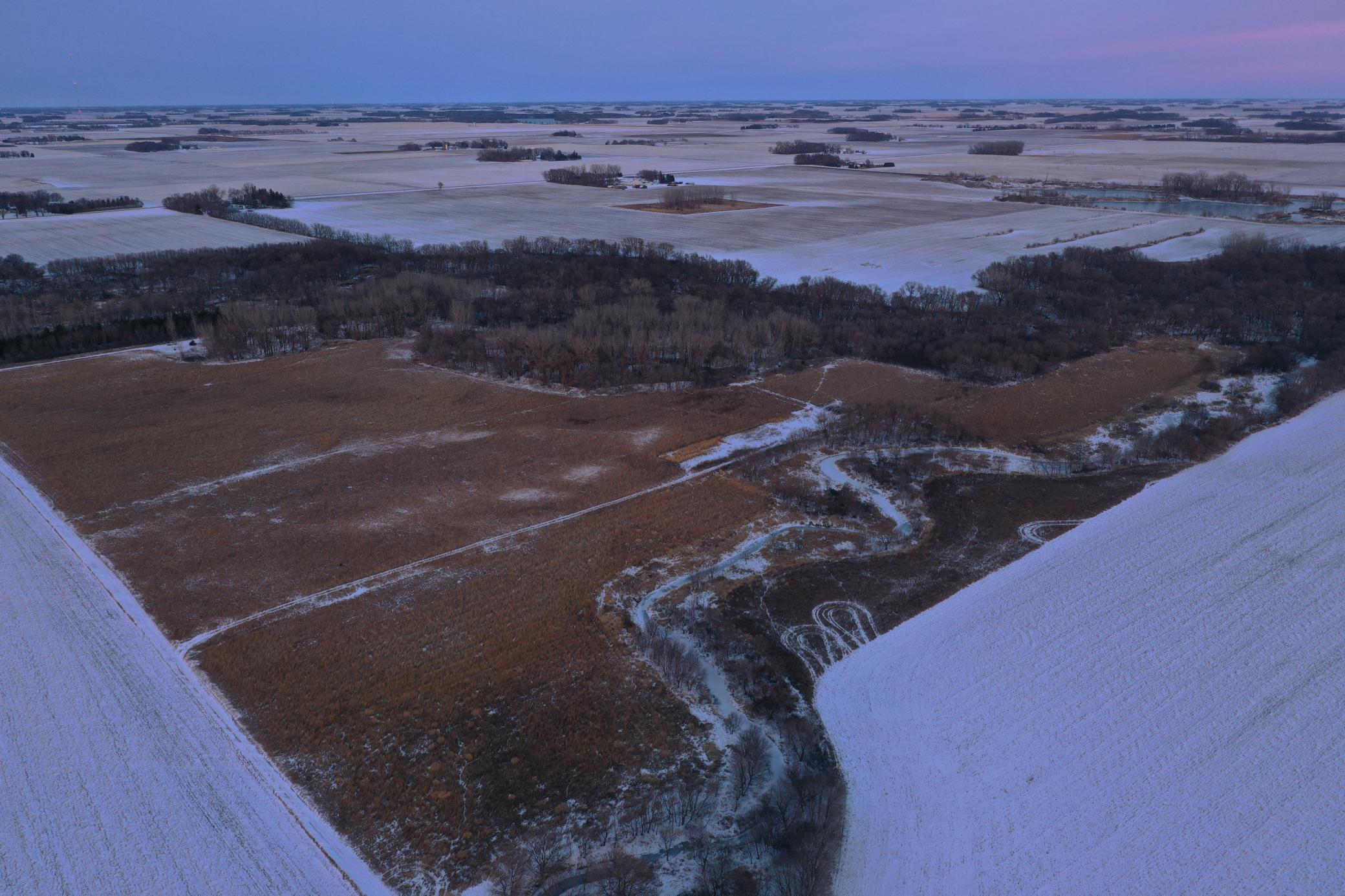
Topography:
Rolling
Contract Information
- Allow Auto Valuation Display?
- Yes
- Allow Consumer Comment
- Yes
- Auction Type
- Reserve
- Off Market Date
- 2023-01-03
- Contingency
- None
- Closed Date
- 2023-03-13
- Original List Price
- Yes
- Sales Close Price
- 3218694
- ListPrice
- Yes
- Owner is an Agent?
- No
- Auction?
- Yes
Location Tax and Other Information
- House Number
- 000
- Street Name
- 290th Street
- Postal City
- Saint James
- County
- Watonwan
- State
- MN
- Zip Code
- 56081
Acreage Information
- Tillable Acres
- 109.58
Additional Parcels Information
- Property ID #2
- 090180910
More Information
Assessments
- Tax With Assessments
- 6256
- Assessment Balance
- 0
Builder Information
- Builder Restrictions
- Open
Lease Details
- Land Leased
- Not Applicable
Miscellaneous Information
- FIPS Code
- 27165
- Homestead
- No
Ownership
- Fractional Ownership
- No
Public Survey Info
- Range#
- 31
- Section#
- 18
- Township#
- 107
Office/Member Info
- Association
- MAAR
- MLSID
- RMLS
Location, Tax and Other Information
- AssocFeeYN
- No
- Map Page
- 999
- Municipality
- Riverdale Twp
- Rental License?
- No
- School District
- St. James
- School District Phone
- 507-375-5974
- Map Coordinate Source
- King's Street Atlas
- Zip Plus 4
- 263
- Property ID Number
- 090180800
- Tax Year
- 2022
- Tax Amount
- 6256
- In Foreclosure?
- No
- Potential Short Sale?
- No
- Lender Owned?
- No
- Auctioneer License
- 5222018
Directions & Remarks
- Public Remarks
- ***This land sells at auction on 12/20/22 at 310 1st Ave, La Salle, MN at 11:00am, This listing is for Parcels 3, 4 & 5 of 5 that will be selling that day*** This is the moment you’ve been waiting for to own farm land and a wooded site with CRP in Watonwan County. You do not want to miss this chance! Parcel #3: 86.98 total acres, approx. 64.8 acres tillable, Productivity Index: 82.5. approx. 14.5 acres of CRP with contracts ending in 2027 & 2030. Parcel #4: 61.4 total acres, approx. 44.78 acres tillable, Productivity Index: 68.3. approx. 13.74 acres of CRP with contract ending in 2029. Parcel #5: 45 ac total acres, wooded land and approx. 18 acres of CRP with contracts ending in 2027 & 2030. Will own the existing field road along the south-west side of the parcel up to the point in which it turns straight north.
- Directions
- From La Salle, take Co Rd 27 west to the first curve and turn onto 290th St, after a mile parcels 3-5 will be on the north side of the road.
Development Status
- Raw Land
- Yes
Insurance Fee
- Insurance Fee
- 0
Restriction/Covenants
- None
- Yes
Special Listing Conditions
- Auction
- Yes
Topography
- Rolling
- Yes
Available Utilities
- None Connected
- Yes
Improvements
- Public Road
- Yes
Land Inclusions
- None
- Yes

Listing Office:
Mages Land Co & Auction
Last Updated: June - 03 - 2025
The data relating to real estate for sale on this web site comes in part from the Broker
Reciprocity SM Program of the Regional Multiple Listing Service of Minnesota, Inc. The information provided is deemed reliable but not guaranteed. Properties subject to prior sale, change or withdrawal.
©2024 Regional Multiple Listing Service of Minnesota, Inc All rights reserved.