
1819 64th Avenue N, Fargo, ND 58102
$425,000
Property Type:
Land
Lot Size (sq. ft.):
399,881
Status:
Closed
Current Price:
$425,000
List Date:
10/02/2025
Last Modified:
2/03/2026
Overview
Description
Listing Details MLS# 6797476
General Property Information
- Comp Sale YN
- No
- Development
- No
- Lot Measurement
- Acres
- Multiple PIDs?
- No
- Plat Recorded
- Yes
- Road Btwn WF & Home?
- No
- Waterfront YN
- Yes
- Yearly/Seasonal
- Yearly
- Zoning
- Forestry
- Lot Dimensions
- va
- Acres
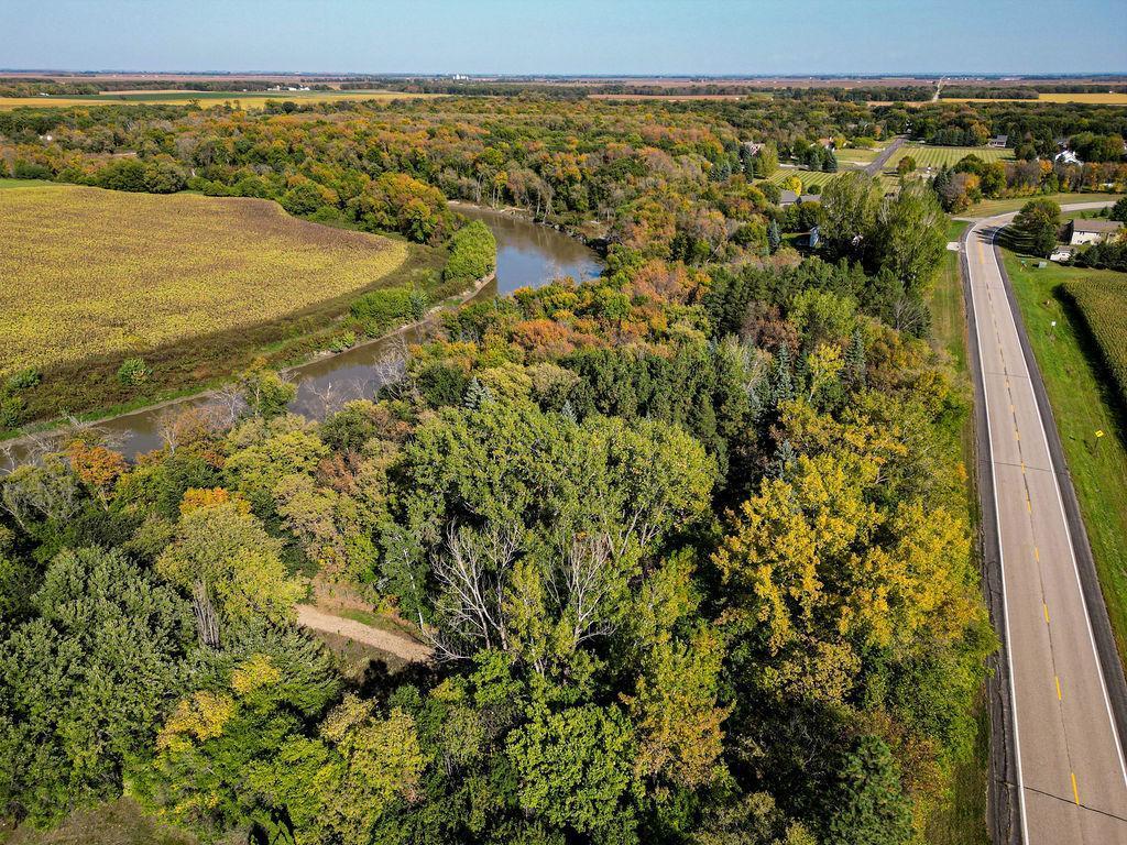
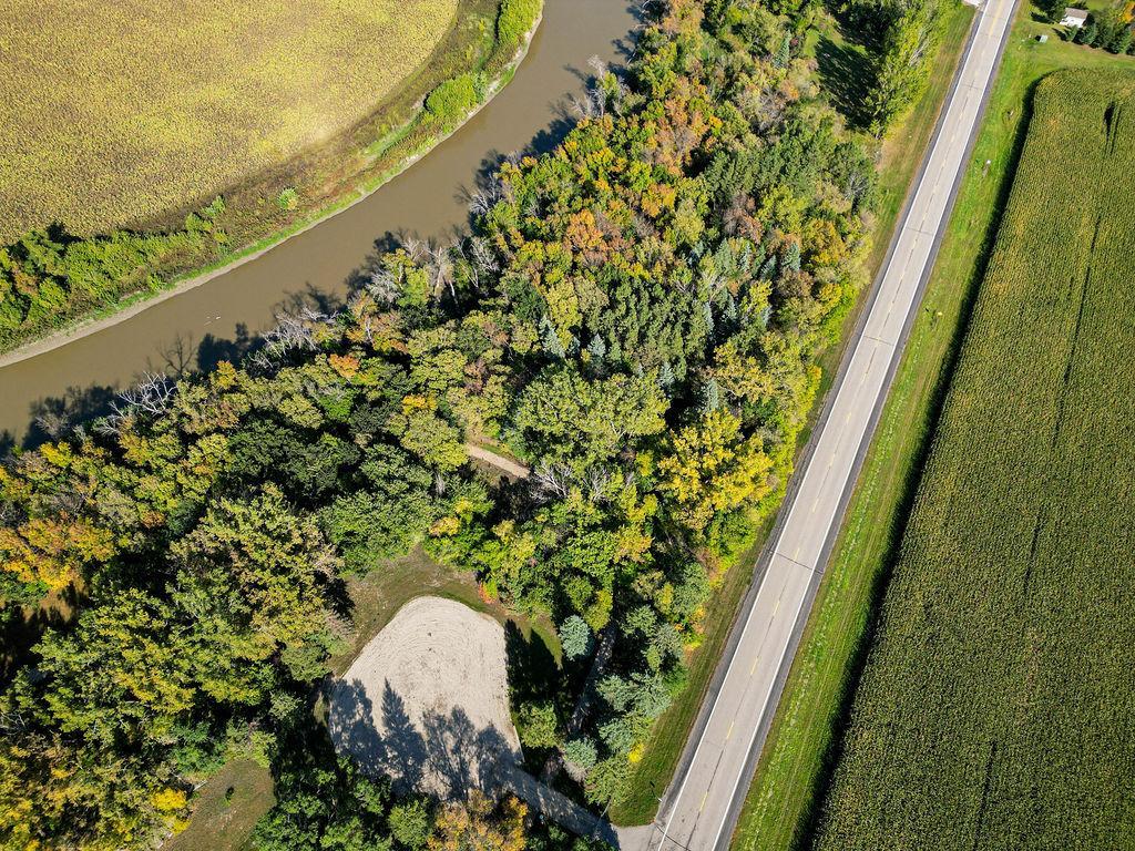
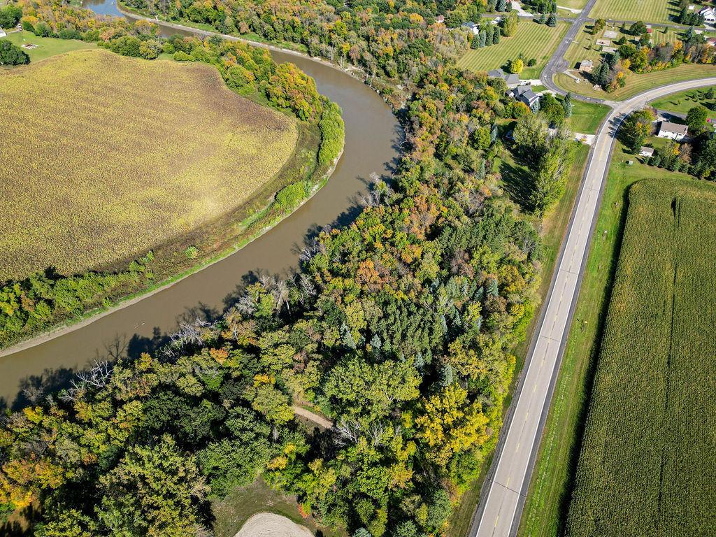
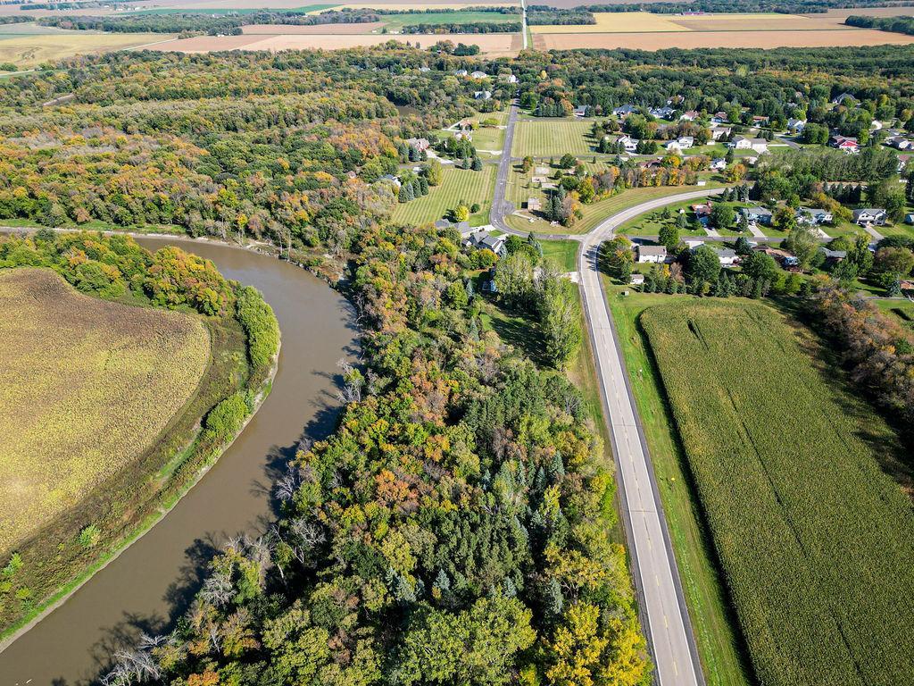
- 9.18
- Lake/Waterfront Name
- Red River
- Association Fee
- 0
Property Features
Available Utilities:
Water Available; Water Connected
Development Status:
Raw Land
Financing Terms:
Conventional
Improvements:
Other
Land Inclusions:
Easements
Lot Description:
Tree Coverage - Heavy
Property SubType:
Acreage
Topography:
Flood Plain
Contract Information
- Off Market Date
- 2025-12-16
- Contingency
- None
- Closed Date
- 2026-01-27
- Original List Price
- 425000
- Sales Close Price
- 425000
- ListPrice
- 425000
- Owner is an Agent?
- No
- Auction?
- No
Location Tax and Other Information
- House Number
- 1819
- Street Name
- 64th
- Street Suffix
- Avenue
- Street Direction Suffix
- N
- Postal City
- Fargo
- County
- Cass
- State
- ND
- Zip Code
- 58102
Assessments
- Tax With Assessments
- 336
- Assessment Balance
- 0
Builder Information
- Builder Restrictions
- Open
More Information
Lease Details
- Land Leased
- Not Applicable
Miscellaneous Information
- Homestead
- No
Ownership
- Fractional Ownership
- No
Public Survey Info
- Range#
- 49
- Section#
- Yes
- Township#
- 140
Office/Member Info
- Association
- FMR
Location, Tax and Other Information
- AssocFeeYN
- No
- Legal Description
- 1-140-49 DESC TR COM AT PT WHICH LIES 1853.39' E & 290.70' N OF SEC COR BETWN SEC 1 2 11 & 12 SD 1853.39' BEING MEAS ALG SEC LN BETWN SEC 1 & 12 & SD 290.70' BEING MEAS PER TO SEC LN & PT BEING PT OF BEG, THEN N 56 DEG 52' W 131.36', THEN S 00 DEG 00 ' E 71.80', THEN S 90 DEG 00' W 50' THEN S 00 DEG OO' E 290.70' THEN S 90 DEG 00' W ALG SEC LN FOR 340' THEN N 31 DEG 40' E 134,20' THEN N 72 DEG 57' E 75.82' THEN N 01 DEG 54' E 193.50' THEN N 13 DEG 33' W 123,52' THEN N 88 DEG 34' E 115' THEN N 41 DEG 21' E 163' MORE OR LESS TO PT OF INTERSEC WITH W BANK OF RED RIVER, THEN SELY ALG W BANK OF RED RIVER 185' MORE OR LESS TO PT OF INTERSEC OF W BANK OF RED RIVER & A LN WHICH PASSES THRU PT OF BEG & HAS A BEARING OF N 00 DEG 00' W THEN S 00 DEG
- Listing City
- Fargo
- Map Page
- 999
- Municipality
- Fargo
- School District
- Fargo
- DNR Lake Classification
- Not Applicable
- Zip Plus 4
- 8549
- Property ID Number
- 60000000040000
- Tax Year
- 2024
- Tax Amount
- 336
- In Foreclosure?
- No
- Potential Short Sale?
- No
- Lender Owned?
- No
Directions & Remarks
- Public Remarks
- This private oasis on the river consists of 4 parcels totaling 9.18 acres with beautiful tree coverage for ultimate privacy. (See Documents for detailed information on parcels.) Property is fully fenced and ready for your new build or recreational land.
- Directions
- No 64th ave East to 18th st
Development Status
- Raw Land
- Yes
Financing Terms
- Conventional
- Yes
Insurance Fee
- Insurance Fee
- 0
Lake Details
- Lake Depth
- No
Lot Description
- Tree Coverage - Heavy
- Yes
Restriction/Covenants
- Minimum Lot Size
- Yes
Topography
- Flood Plain
- Yes
Available Utilities
- Water Available
- Yes
- Water Connected
- Yes
Improvements
- Other
- Yes
Land Inclusions
- Easements
- Yes
Property SubType
- Acreage
- Yes

Listing Office:
Berkshire Hathaway HomeServices Premier Properties
Last Updated: February - 03 - 2026
The data relating to real estate for sale on this web site comes in part from the Broker
Reciprocity SM Program of the Regional Multiple Listing Service of Minnesota, Inc. The information provided is deemed reliable but not guaranteed. Properties subject to prior sale, change or withdrawal.
©2024 Regional Multiple Listing Service of Minnesota, Inc All rights reserved.